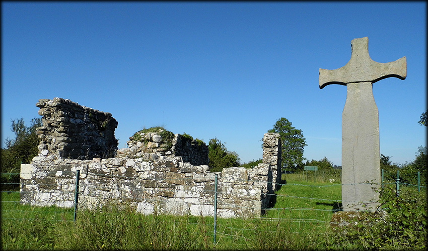
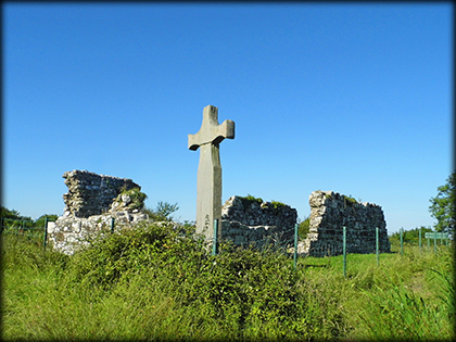
Inishmacsaint / Inis-maige-samh Medieval Church, Cross and Early Christian Site The Early Christian monastery was founded on Inishmacsaint, in the early quarter of the 6th century, by St Ninnidh a grandson of Laoghaire, High King of Ireland. The site consists of an 18.4 metre long church and a possible 12th century stone cross, to the south of the church is a rectangular cillín. The church stood inside a possible early Christian enclosure, the last banks of which, were removed in the 1970s. The church was built in two stages, the oldest part, possibly 10th century, is the west end, it was probably extended to the east in the 12th century.
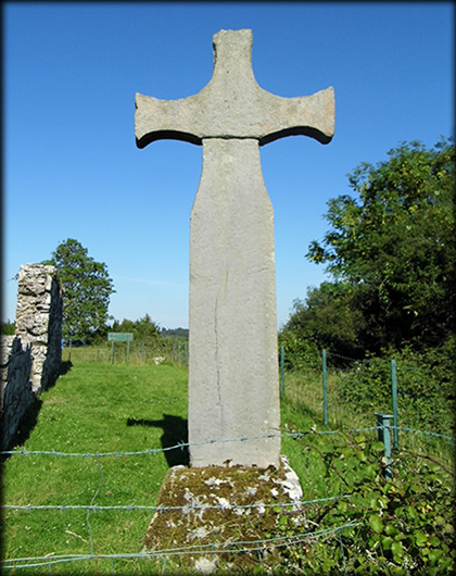
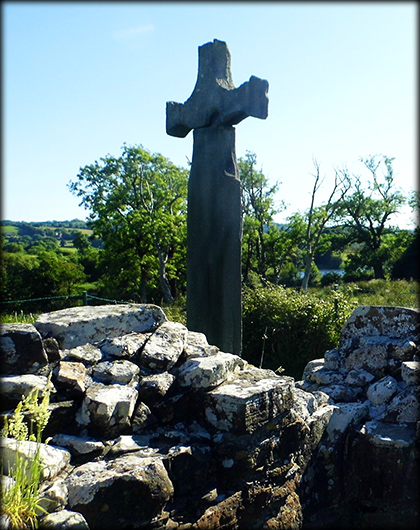
Standing at 4 metres high, the plain sandstone cross totally dominates the surrounding landscape. It is has a single piece shaft with a tenon joint at either end. The lower tenon sits in a limestone base and the head slots onto the top one. The outlines of decorative panels can be seen on the ends of the arms, the underside of the head and the top of the shaft. Inishmacsaint, Irish: Inis-maige-samh meaning 'Island of the Sorrel Plain' is a beautiful , tranquil site located on Lower Lough Erne. |
|
 |
 |
|
Situated: From Silverhill travel north on the A46 for about 10 kilometres. take a right turn onto Lough Shore Rd. 1/2 Kil turn right. Park at the car-park I. K from here and walk over the bridge to the island. Discovery Map 17: H 1656 5412. Last visit . Longitude: 7° 44' 43.8" W Latitude: 54° 26' 08.0" N Photos: José Gutiérrez. |
 |
| Ref: Northern Ireland Sites and Monuments Record website. | |